
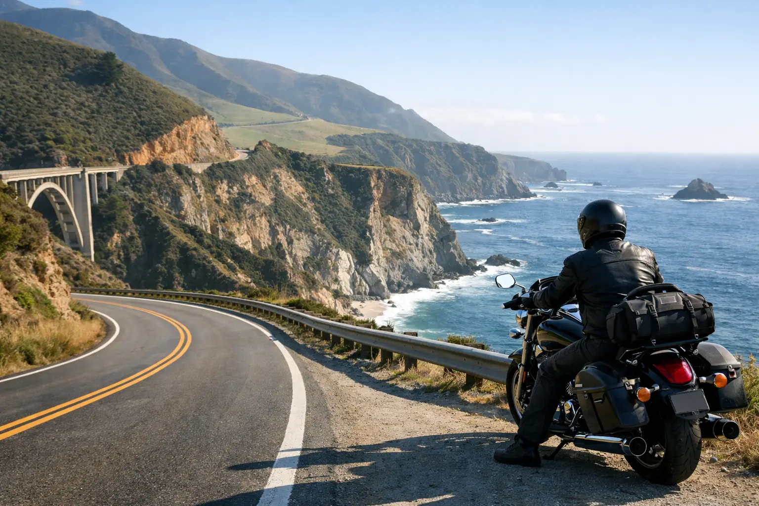
Plan a Pacific Coast Highway motorcycle loop with coastal curves, Big Sur timing, fuel stops, weather strategy, and routes that fit your riding level.
The best Pacific Coast Highway motorcycle loop is rarely the biggest one on the map. It is the one that gives you enough time to settle into the corners, stop when the fog lifts off the water, and get back before coastal temperatures drain the fun from the ride. California’s Highway 1 can be a dream on two wheels, but it is also slow, changeable, and frequently affected by closures. Plan it like a motorcycle ride, not a road-trip checklist.
For most riders, the smart approach is to build a loop around one standout stretch of coast, then use an inland road for a completely different return leg. That gives you ocean views on the way out, twisties and warmer conditions on the way back, and far less backtracking than an out-and-back day.
What Makes a Pacific Coast Highway Motorcycle Loop Work
The Pacific Coast Highway is not one continuous, predictable riding experience. Around Santa Monica and Malibu, it is an urban coastal cruise with traffic lights, driveways, cyclists, and weekend congestion. North of Monterey, it becomes the Big Sur ride riders picture: cliffside pavement, redwood canyons, tight curves, and very few fast miles. Farther north, the coast can be remote, windy, and cold even when inland California is baking.
A good loop accounts for that reality. Start early, ride the coast in the direction that places the ocean beside you, then cut inland before late-afternoon traffic and marine-layer chill take over. Southbound is the classic choice on much of Highway 1 because the Pacific sits to your right, although pullouts and photo stops can be easier to enter when traveling north. There is no universal answer. Traffic, road conditions, and where you start matter more than a rigid rule.
The other key factor is pace. Highway 1 mileage is deceptive. A 100-mile coastal segment can take three hours of moving time, and that is before scenic stops, construction flaggers, lunch, or a line of RVs through a no-passing section. Build a route with breathing room. The best view of Big Sur is not much fun when you are chasing daylight and a fuel warning.
The Best Loop for a Big Sur Ride
For a full-day Northern California run, base yourself in Monterey, Carmel, or the Santa Cruz area. A practical Big Sur loop begins in Monterey, follows Highway 1 through Carmel and down the Big Sur coast, then turns inland on Carmel Valley Road and returns through Salinas or the Monterey back roads. Exact distance depends on your turnaround point and chosen inland connectors, but expect roughly 150 to 220 miles and six to eight hours with stops.
Ride Highway 1 South, Then Let the Coast Decide Your Turnaround
Leave Monterey early enough to pass Carmel before the breakfast crowd and reach the best Big Sur overlooks while the road is still calm. The pavement south of Carmel rewards smooth inputs more than aggression. Curves tighten without much warning, shaded sections can stay damp, and sand or gravel often collects near pullouts after wind or rain.
Bixby Creek Bridge is worth seeing, but do not make it the whole ride. The road becomes more interesting as it runs south into the Big Sur region, alternating between exposed cliff sections and wooded bends. If Highway 1 is fully open, you can continue toward Julia Pfeiffer Burns State Park, McWay Falls, and the southern Big Sur coast before turning inland. If a closure blocks through access, treat the closure point as your turnaround and build the inland portion from Carmel Valley instead.
That flexibility matters. Winter storms, landslides, emergency repairs, and long-term construction can change this area fast. Never assume that a route from last season is currently rideable. Check conditions the evening before and again on ride morning, especially if your plan depends on a specific Highway 1 connector.
Return Through Carmel Valley for Faster, Warmer Miles
Carmel Valley Road is the natural contrast to the coast. It trades ocean exposure for ranch country, rolling pavement, and warmer air. It is generally less technical than the tighter coastal sections, making it a good reset after several hours of scenic cornering. There are still blind bends, wildlife, agricultural vehicles, and occasional rough patches, so keep the pace honest.
For newer riders, make the coastal section shorter and turn inland early. You still get the signature Highway 1 experience without finishing the day tired from hours of low-speed curves. Experienced riders can extend the loop with additional inland roads, but do not add them simply to raise the mileage. Big Sur is a place to enjoy, not a place to race between pins.
A Southern California Pacific Coast Highway Motorcycle Loop
If you are starting around Los Angeles, the Malibu-to-Ojai loop is often a better use of a single day than trying to force a long ride north on Highway 1. It combines a coastal cruise with real canyon riding and gives renters a route that is easy to access from the city.
Start in Santa Monica or Malibu and ride west along the coast early. Once you reach the Point Mugu area, turn inland through the Santa Monica Mountains or toward Ojai, depending on the roads open and your comfort level. The return can follow the Ventura coast before rejoining Highway 1. Plan on 140 to 200 miles, but reserve a full day. Malibu traffic can make a short route feel long, particularly on warm weekends.
This loop has a different character from Big Sur. You will deal with more local traffic, more law enforcement, more driveways, and more riders sharing the road. It is excellent for a relaxed cruiser, standard, or touring bike. A sport bike can be a lot of fun in the inland sections, but the coast itself rewards patience, not speed.
Weather and Gear: The Coastal Reality Check
California coast weather has a way of embarrassing riders who pack for the forecast at their hotel. You may leave Monterey in the low 50s under fog, climb inland into the 70s, then return to wind and cold air near the water. Southern California can produce the same pattern, with a sunny valley separated from a chilly shoreline by only a few miles.
Bring a layer you can add without unpacking half your luggage. A vented jacket with a windproof liner works well for summer, while shoulder-season rides call for insulated layers and waterproof gloves. Visibility is just as important as comfort. Fog can settle quickly around Big Sur, and a lightly tinted shield that feels fine at noon may be a poor choice in gray morning conditions.
Before leaving, check four things: current Highway 1 closures, wind direction and gusts, temperatures at both coast and inland elevations, and sunset time. These details shape the route more than a generic weather icon. Strong onshore winds can make exposed sections tiring, while a wet road under redwoods may stay slick long after the sky clears.
Fuel, Food, and Motorcycle Setup
Fuel availability is one reason to avoid treating Highway 1 casually. Fill up in Monterey, Carmel, or Morro Bay before committing to a long coastal segment, depending on your direction. Do not count on every small community having open fuel at the moment you arrive, particularly outside peak travel periods. On a rental bike, take five minutes to confirm tank range and whether the fuel gauge is trustworthy before heading into sparse country.
A large touring bike is comfortable for the miles but can feel like work at crowded overlook pullouts and tight, off-camber parking areas. Midweight adventure bikes, standards, and sport-tourers are especially well suited to these loops because they handle variable pavement without giving up highway comfort. Newer riders should choose a bike they can confidently paddle backward on uneven ground. The view is not worth a preventable low-speed tip-over.
Keep luggage simple and secure. Coastal wind will expose loose straps, and the repeated braking and cornering of Highway 1 can shift a poorly packed tail bag. Carry water, a snack, a phone backup battery, and a physical plan for where you will turn around if weather or road conditions deteriorate.
Build the Loop Around Your Actual Ride Day
A route planner should ask more than where you want to go. Your experience level, bike type, daylight window, passenger, and appetite for tight curves all change the right Pacific Coast Highway motorcycle loop. A confident solo rider with eight hours can combine Big Sur overlooks and Carmel Valley. A couple on a rented bagger may have a better day with a shorter coast run, a long lunch in Carmel, and an unhurried inland return.
CharterNow.ai can help turn those variables into a motorcycle-specific itinerary, including estimated ride time, live weather context, scenic stops, and rental options when you are flying in. The value is not adding every famous viewpoint. It is knowing which roads make sense together on the day you actually have.
Give the coast the time it demands, leave room for a change of plan, and turn inland while you still want another set of curves. That is how a Pacific Coast loop becomes a ride you remember for the road, not the traffic.