
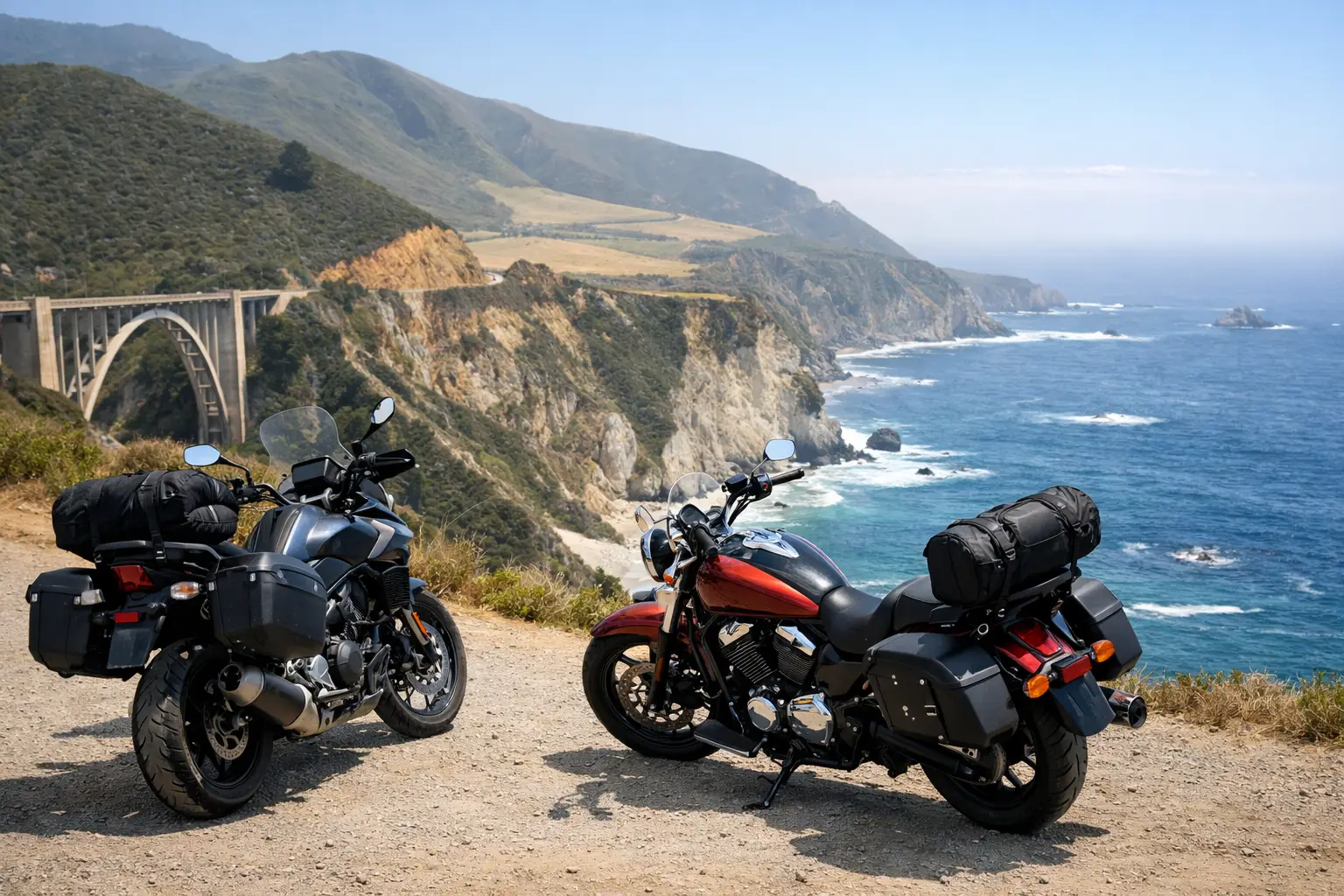
Plan a 3 day motorcycle road trip itinerary from San Francisco to Big Sur with scenic roads, realistic ride days, weather backups, and pro rental advice.
A short motorcycle trip gets spoiled when Day 1 turns into a frantic freeway slog, Day 2 is packed with too many photo stops, and Day 3 becomes a race to return the bike. This 3 day motorcycle road trip itinerary is built differently: manageable saddle time, memorable pavement, and enough flexibility to handle coastal fog, wind, or a late start.
The route begins and ends in San Francisco, making it a strong option for local riders, fly-and-ride visitors, and renters picking up a bike in the Bay Area. It follows the coast to Monterey and Big Sur, then returns through quieter inland roads. Expect ocean overlooks, redwoods, sweepers, and a few proper twisty sections without making every mile an endurance test.
Why this 3 day motorcycle road trip itinerary works
The San Francisco-to-Big Sur corridor is famous for a reason, but it can punish an overplanned weekend. Highway 1 moves slowly through beach towns, scenic pullouts fill early, and wind can turn a warm inland forecast into a chilly ride by the water. The best plan leaves room for all of that.
This itinerary keeps each day in the roughly 130- to 210-mile range, depending on detours. That is enough time to ride with purpose, stop when a view deserves it, and arrive before dinner rather than after dark. It suits confident newer riders on a cruiser, standard, or touring bike, while experienced riders can add side roads for more technical pavement.
The route assumes a Friday-through-Sunday ride, but it works on any three consecutive days. Summer offers long daylight but heavier traffic and marine fog. Spring and fall often deliver clearer roads and cooler temperatures. Winter can be spectacular between storms, though rain, mud, fallen debris, and road closures require a more conservative plan.
Day 1: San Francisco to Monterey by way of Santa Cruz
Approximate distance: 145 to 175 miles Moving ride time: 4 to 5 hours Best for: Settling into the trip, coastal cruising, redwoods, and food stops
Leave San Francisco after the worst of the morning traffic, ideally around 9 a.m. Cross south through Pacifica and follow the coast toward Half Moon Bay. This first stretch is not about attacking corners. It is about shaking off city traffic, getting used to the bike, and remembering that coastal temperatures can run 15 to 25 degrees cooler than inland forecasts.
From Half Moon Bay, continue south toward Pescadero. This is a good place for coffee, fuel, and a quick gear adjustment before the road gets more interesting. Then turn inland toward the Santa Cruz Mountains if conditions are dry. Roads through this area deliver the kind of tight, shaded curves that reward smooth throttle control, not aggressive riding. Redwood cover can hold moisture well into the day, especially after fog or rain.
Drop into Santa Cruz for lunch, then continue south toward Monterey. You can stay close to the ocean for a more relaxed finish, or work in a short detour through the hills if the group has energy. Check into Monterey, Pacific Grove, or Carmel before the late afternoon traffic builds.
For an easy evening ride, cruise around Pacific Grove and the Monterey Peninsula. The pace is slow, the scenery is excellent, and it gives you a chance to spot deer and get your bearings for the next day. Avoid treating this as a high-speed lap. There are cyclists, pedestrians, tourists, and frequent low-speed turns.
Day 1 rider notes
Fuel is easy to find along the coast, but do not wait until the warning light comes on before leaving Santa Cruz. If you are on a rental bike, use the first day to confirm luggage straps, windshield position, seat comfort, and phone mount security. A five-minute adjustment in a parking lot is much better than an hour of fighting a flapping bag on Highway 1.
Day 2: Monterey to Big Sur and back
Approximate distance: 130 to 190 miles Moving ride time: 4 to 6 hours Best for: The headline scenery, cliffside curves, and a no-rush riding day
Day 2 is the reason to leave your luggage in one hotel. Start early, ideally before 8 a.m., and ride south from Monterey through Carmel toward Big Sur. Early light is better for the coastline, traffic is lighter, and you have more time to adapt if fog rolls in.
The famous bridges, coves, and cliffside views are all here, but the road itself demands attention. Highway 1 is scenic, not technical in a track-day sense. Its challenge comes from blind bends, uneven pavement, slow-moving cars, cyclists, and drivers who stop suddenly when they spot an overlook. Keep a generous following distance and do not fixate on the ocean when the road is turning.
Make your first longer stop at a viewpoint rather than trying to pull off at every turnout. That small decision keeps the day from becoming stop-start tourism. Continue south as far as road conditions and your comfort allow, then turn around while you still have energy. For many riders, the sweet spot is a lunch stop in the Big Sur area followed by a relaxed northbound return to Monterey.
A key local reality: Highway 1 south of Big Sur has a history of landslides, construction work, and weather-related closures. Do not assume a map app's route is rideable just because it draws a blue line. Check official road status on the morning you ride. If the southbound route is limited, that does not ruin the day. Ride the open coastal section twice, take your time at the overlooks, and add the Carmel Valley loop on the way back.
Add mileage only if the conditions are right
Experienced riders on a clear, dry day can add Carmel Valley Road and nearby inland connectors to build a longer loop. Those roads bring warmer air, faster sweepers, and a welcome break from coastal traffic. They also have less services, more changing surfaces, and more wildlife near dusk.
Newer riders should skip the urge to maximize mileage. Big Sur is better when you can pull over, take off your helmet, and listen to the surf instead of watching the clock. The road will still be there tomorrow. Your margin for error may not be.
Day 3: Monterey to San Francisco through inland curves
Approximate distance: 165 to 210 miles Moving ride time: 4.5 to 6 hours Best for: Warm inland riding, sweepers, and a satisfying finish
For the return, avoid simply retracing the coast unless fog and weather make that the safer choice. Head inland through the Carmel Valley area, where the temperature rises, the pavement opens up, and the ride feels more like a final-day victory lap than a commute home.
The exact route should depend on your bike, skill level, and return deadline. Riders with a late rental return or a flight the next morning should choose the most direct inland route and save the wandering for another trip. If you have time, connect through the Santa Cruz Mountains before heading north toward the Bay Area. The tighter roads are rewarding, but fatigue matters on the final day. Take a break before the last technical section, not after it.
Aim to be back in San Francisco by mid- to late afternoon. Bay Area traffic can erase an hour quickly, and rental returns are rarely the place to test how flexible a schedule can be. Fill the tank close to the return location, remove personal items from every bag and cubby, and photograph the bike if you rented it.
Pack for the coast, not the forecast screenshot
A 68-degree forecast in Monterey can feel very different when fog, wind, and sea air are involved. Bring a vented jacket with a waterproof layer or a separate rain shell, full-finger gloves, eye protection, and a warm midlayer that packs small. Waterproof boots are a smart call outside the driest months.
Keep water and snacks accessible. Scenic Highway 1 has stretches where food and fuel are not as convenient as they look on a map, and a missed meal makes even good pavement feel tedious. A compact tire repair kit and portable inflator make sense for riders on their own machines. Rental riders should know the provider's roadside-assistance process before departure.
Build in weather and road-closure backups
The smartest itinerary is not the one with the most pins on it. It is the one that still produces a good ride when weather changes. If coastal fog is thick, wait an hour, take an inland route first, or shift your Big Sur run later in the day. If rain arrives, shorten the route and choose roads with predictable pavement over narrow, shaded backroads.
For a personalized version, CharterNow.ai can build a route around your dates, starting point, motorcycle style, skill level, and preferred ride intensity, then account for live weather and realistic ride times. That matters most on a three-day trip, where one bad assumption can consume a third of your vacation.
Big Sur is not a place to conquer in a weekend. It is a place to ride with enough time to notice the road changing beneath you, the temperature dropping near the water, and the moment the next curve opens onto the Pacific. Leave a little space in the plan. That is where the best part of the trip usually happens.